

Watershed Protection in Dominica
Watershed protection in Dominica represents the most critical intersection of environmental stewardship and national security for the Nature Island as it moves toward its 2030 goal of becoming the world’s first climate-resilient nation. With 365 rivers, numerous high-altitude lakes, and some of the most intact tropical rainforests in the Caribbean, Dominica’s wealth is measured not in gold, but in its freshwater. However, the catastrophic impact of Hurricane Maria in 2017, which stripped 80% of the island’s forest cover and triggered over 10,000 landslides, served as a definitive warning: without a robust, scientifically managed watershed system, the island’s greatest asset becomes its most significant vulnerability.
Watershed management has evolved from a purely ecological concern into a complex multi-agency strategy involving the Forestry & Wildlife Division, the Dominica Water and Sewerage Company (DOWASCO), and the Climate Resilience Execution Agency for Dominica (CREAD).
The Anatomy of a Dominican Watershed
A watershed in Dominica is characterised by extreme topography. The island’s central mountain spine, rising to 1,447 meters at Morne Diablotins, creates a vertical water system in which rain falls at the peaks and descends rapidly through steep, narrow valleys to the sea.
Key Hydrological Zones
- The High-Altitude Catchment: Areas like the Morne Trois Pitons National Park act as a massive sponge. The mossy cloud forests here trap moisture from trade winds, feeding the headwaters of the Roseau River, Layou River, and Pagua River.
- The Riparian Buffers: These are the critical transition zones of vegetation alongside riverbanks. The government has mandated a 50-meter no-build buffer around all new industrial developments, such as the Deux Branches quarry, to prevent sediment runoff from reaching waterways.
- The Estuaries: Where fresh water meets the Caribbean Sea or Atlantic Ocean. These zones are vital for the island’s Blue Economy and fisheries, but they are also the most prone to flooding.
Legislative and Institutional Framework
Three primary pieces of legislation anchor the legal protection of Dominica’s water resources:
- The Forests Act (Chapter 60:01): This grants the President the power to declare any private land a Protected Forest if it is deemed essential for the maintenance of water supplies in springs and rivers.
- The Water and Sewerage Act (Cap 43:40): This gives DOWASCO the exclusive license to manage and protect the catchments used for public consumption. In February 2026, new regulations under S.R.O. 14 updated the water guarantee charges to fund the modernisation of these rural catchments.
- The Forestry and Wildlife Act (Cap 60:02): Prohibits the depositing of deleterious substances into any stream or waterway, a law strictly enforced in 2026 as industrial activity (quarrying and geothermal) expands.
The Geothermal and Green Hydrogen Factor
A unique challenge for watershed protection is the rise of the Geothermal energy sector. The Laudat Geothermal Power Plant, slated to power 23,000 homes by the end of this month, sits in the heart of the Roseau River watershed, in the Roseau valley.
The Water-Energy Nexus
The production of green hydrogen and ammonia requires massive amounts of water for electrolysis:
2H2O + energy → 2H2 + O2
To protect domestic drinking water, the government has implemented a non-competition policy. Industrial water for hydrogen production is increasingly sourced from desalination or deep-bore non-potable wells, ensuring that the high-quality surface water from the mountains remains reserved for agriculture and human consumption.
Major Resilience Projects
Dominica is currently implementing some of the most advanced watershed resilience projects in the SIDS (Small Island Developing States) network.
The DOMCREP Project (GCF-Funded)
Signed in November 2025 and officially launched in March 2026, the Dominica Community Resilience Enhancement Project (DOMCREP) is a $70.2 million (XCD) initiative.
- Focus: It targets eight of the most flood-prone communities.
- Watershed Component: The project uses Nature-Based Solutions (NBS) like reforestation of degraded slopes and the construction of gabion check dams to slow the velocity of mountain runoff during heavy rains.
The Colihaut River Defense Wall
Completed in early 2026, this project represents the Hard Infrastructure side of watershed protection. By stabilising the river embankment in the Colihaut community, the government is preventing the type of catastrophic scouring that destroyed entire villages during past tropical storms.
Modern Threats and Management Strategies
While hurricanes are the most visible threat, silent threats to Dominica’s watersheds require constant vigilance in 2026.
Siltation and Quarrying
As Dominica completes its International Airport Project and new housing, the aggregate demand has increased. The Stonefield Quarry and Crushing Plant at Deux Branche has become a test case for modern mitigation.
“We have established three concreted sedimentation ponds to ensure that silt does not enter the river system,” noted Assistant Forest Officer Kelvin Felix in January 2026. This reflects a shift toward Industrial Environmentalism.
Climate-Driven Drought
Despite its name, Dominica is not immune to drought. The Climate Resilience and Recovery Plan (CRRP) notes that by 2030, Dominica could face longer dry spells. Watershed protection now includes installing bulk water storage tanks and protecting emergency springs used only during periods of extreme water stress.
Landslides and Slope Stability
The extreme steepness of the Dominican terrain means that a watershed is only as healthy as the trees on its slopes. The Division of Agriculture is actively discouraging “root crop” farming on slopes greater than 20 degrees, promoting agroforestry (planting coffee, cocoa, and fruit trees) instead, as these deeper-rooted plants act as natural rebar for the soil.
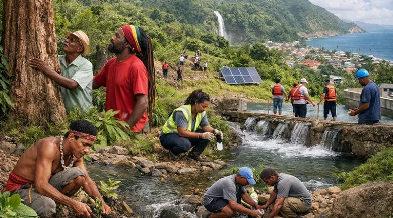
Community-Led Protection (The “Eco-Guardians”)
In recent years, watershed protection has moved from a top-down government mandate to a community-led model. Through the Sustainable Land Management (SLM) Project, local Water Committees in villages like Grand Bay and St. Joseph are trained to monitor turbidity (cloudiness) in their rivers.
Community Actions Include:
- River Cleansing Programs: Regular removal of debris and invasive bamboo that can cause “debris dams,” which lead to flash floods.
- Riparian Replanting: Local schools participating in “One Child, One Tree” programs focused on riverbanks.
- Monitoring Migration: As noted in the IOM 2026 Global Appeal, the movement of people into fragile watershed areas is a growing concern. The government is using GIS mapping to ensure that new settlements for asylum seekers or displaced persons are located outside of critical catchment zones.
Comparative Analysis: Watershed Management
| Feature | Pre-Maria (2017) | Modern Era (2030) |
| Strategy | Reactive / Recovery-based | Proactive / Resilience-based |
| Technology | Manual Gauge Monitoring | Automated Hydromet Network |
| Data Use | Limited | Integrated GIS / Satellite Mapping |
| Funding | Mostly Domestic | Multi-lateral (GCF, World Bank, CDB) |
| Energy Link | Independent | Integrated with Geothermal/Hydrogen |
The Roadmap to 2035
As we look toward a 2035 roadmap, the success of Dominica’s watershed protection will be the ultimate litmus test for its “Climate Resilient” status. The goal would be to reach 67% protected forest cover by 2035, ensuring that every drop of rain that falls on the island is managed from the “Cloud to the Coast.”
By combining high-tech monitoring (the new Hydromet Network) with ancient ecological wisdom (reforestation), Dominica is ensuring that its 365 rivers remain a source of life and energy, rather than a source of destruction. The fire of the volcanoes may be the island’s new engine, but the water of its watersheds remains its lifeblood.


References
-
1.
Climate Resilience and Recovery Plan (CRRP) 2020-2030 https://odm.gov.dm/wp-content/uploads/2022/02/CRRP-Final-042020.pdf
-
2.
World Bank: Dominica Disaster Vulnerability Reduction Project https://projects.worldbank.org/en/projects-operations/project-detail/P129992
-
3.
UNESCO: Morne Trois Pitons National Park https://whc.unesco.org/en/list/814/