Sustainable Land Management (SLM) in Dominica
Sustainable Land Management (SLM) in Dominica is a fundamental structural necessity for preserving the nation’s topsoil, which serves as the primary asset of its volcanic, agrarian economy. As the most mountainous island in the Lesser Antilles, Dominica’s verticality defines its identity but also dictates its physical fragility. Over several decades, the SLM framework has transitioned from a fragmented series of conservation efforts into a centralised, data-driven methodology under the National Resilience Development Strategy. This strategic shift addresses the historical legacy of soil erosion and land degradation, which have long threatened the island’s ecological and economic stability.
The Historical Evolution of Land Governance
The history of land management on the island begins with the Kalinago people, who utilised a polyculture agroforestry system that prioritised the maintenance of deep-rooted tree species alongside food crops. This indigenous approach ensured that the steep volcanic slopes remained stabilised even during periods of heavy tropical precipitation. However, the colonial era introduced a plantation-style monoculture that prioritised short-term yield over long-term soil health. The 1950 Forest Ordinance was one of the first legislative attempts to curb this trend by authorising the establishment of forest reserves to protect vital water catchments. These early efforts were significant but often lacked the enforcement mechanisms needed to prevent agricultural encroachment into high-vulnerability zones.
During the mid-20th century, the banana industry led to a dramatic expansion of the agricultural frontier. Smallholders pushed into the interior rainforests, clearing steep slopes to plant shallow-rooted banana trees. While this provided a significant economic boost, it fundamentally altered the island’s hydrology. The loss of primary forest canopy increased surface runoff velocity, leading to a steady decline in soil quality and an increase in downstream siltation. Data from the late 20th century indicates that by the turn of the millennium, the island was losing topsoil at a rate far exceeding its natural regenerative capacity.
The Land Degradation Neutrality Framework
Modern SLM projects operate under the global mandate of Land Degradation Neutrality (LDN), which aims to ensure that the amount and quality of land resources necessary to support ecosystem functions remain stable or increase. By partnering with the Partnership Initiative for Sustainable Land Management (PISLM) and the Global Environment Facility (GEF), Dominica has utilized satellite imagery and ground-level soil sensors to establish comprehensive baselines. These studies historically revealed that over 50% of the island’s total land area exhibited signs of degradation, characterized by reduced soil organic carbon (SOC) and declining vegetation productivity.
The SLM framework does not apply a one-size-fits-all solution; instead, it utilises a parish-specific targeting system based on the severity of degradation. Parishes such as Saint Andrew and Saint David, which have historically faced the most significant agricultural pressure, are the primary focus of “No Net Loss” targets. Conversely, parishes with higher levels of natural regeneration, such as Saint John, are targeted for a “Net Gain” strategy. By segmenting the island in this manner, technical resources, such as bioengineering teams and soil rehabilitation units, are allocated to areas with the greatest immediate impact.
- Achieve no net loss of healthy land in high-pressure parishes by 2030 compared to established baselines.
- Realize a net gain in land health for parishes with high regeneration potential through soil productivity improvements.
- Increase the national forest cover through a combination of assisted natural regeneration and the strategic replanting of indigenous species.
- Reduce the national rate of soil erosion through the implementation of contour farming and bio-engineered barriers.
- Improve Soil Organic Carbon (SOC) stocks and agricultural productivity across managed croplands and grasslands.
Technical Bio-Engineering and the Vetiver Solution
A cornerstone of the national SLM technical strategy is the widespread deployment of Vetiver grass (Chrysopogon zizanioides). Known in engineering circles as “living soil nails,” Vetiver is a non-invasive grass with an extraordinary fibrous root system that can reach depths of 3 to 4 meters. In the loose, volcanic substrate of Dominica, these roots act as a structural mesh, binding the soil together and increasing its shear strength. This is particularly vital for protecting critical infrastructure, including major highways, where slope failures frequently disrupt national logistics.
Beyond its structural benefits, Vetiver hedges serve as a primary hydrological tool. When planted in dense rows along the contours of a hillside, the stiff stems of the grass form a permeable barrier that slows down the velocity of surface runoff during extreme rainfall events. This reduced velocity allows water to infiltrate the soil rather than washing it away, recharging the groundwater table and preventing the siltation of the island’s 365 rivers. Research at various project sites indicates that Vetiver hedgerows can trap up to 90% of suspended sediment, effectively building new terraces of fertile soil behind the grass barriers over time.
The Agricultural Land Lease Facility and Policy Shifts
A landmark policy shift in land governance involved the operationalisation of the Agricultural Land Lease Facility. This initiative specifically targets young and land-constrained farmers to move away from the uncontrolled land-use patterns of the past. The government has historically allocated hundreds of acres of state-owned land across key estates for exclusive agricultural use. The primary objective is to ensure that all lessees adhere to strict SLM protocols, including mandatory contour planting and the maintenance of riparian buffers.
The lease facilities’ financial structure lowers the barrier to entry while supporting soil stewardship. Lands are typically leased at nominal rates for initial terms, but lease renewals are contingent on successful land health audits. This ensures that farmers are not just extracting value from the land but are actively contributing to its rehabilitation. This policy intervention helps align workers’ economic goals with the national mandate for climate resilience and soil conservation.
- Newfoundland Estate and Londonderry Estate in the eastern and northeastern regions.
- Woodfordhill-Mango Gutter and the Wesley-Joe Burton area in the north.
- Morne Prosper and Wotten Waven in the central volcanic highlands.
- Charlotte Valley, Savanne York, and Williams Settlement in the southern corridors.
- Blenheim Estate and the Richmond Estate in the Castle Bruce area.
Human Capital and Indigenous Knowledge Integration
Dominica’s SLM projects place a significant emphasis on the Kalinago Territory, where land is held communally. The Sustainable Livelihoods component focuses on the preservation and inter-generational transfer of traditional Kalinago ecological knowledge. This involves combining ancestral forest management practices with modern Geographic Information Systems (GIS) mapping technology. By strengthening local councils’ capacity to manage forest resources, the project ensures that pristine areas remain protected while still providing sustainable economic opportunities through nature-based tourism.
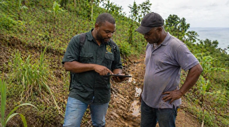
To ensure the long-term viability of these interventions, thousands of stakeholders, including farmers and community leaders, have undergone specialized training. This curriculum covers a wide spectrum of sustainable practices, from the construction of check dams in ravines to the implementation of integrated pest management to reduce chemical loading in the soil. The use of “Farmer Field Schools” allows participants to see data-backed results in real-time. This bottom-up approach is essential for shifting the national culture toward a more proactive form of environmental stewardship.
- Contour Hedgerows: Utilizing Vetiver or lemongrass to create biological filters along the natural curves of the slope.
- Check Dams: Implementing small, semi-permeable rock or wood structures to reduce the velocity of water in drainage ravines.
- Agroforestry Integration: Planting fruit and timber trees within traditional crop plots to provide multiple canopy layers and deeper root stabilization.
- Riparian Buffers: Restoring native vegetation along the banks of rivers to prevent lateral erosion and filter agricultural runoff.
- Soil Mulching: Applying organic materials to the soil surface to preserve moisture, suppress weeds, and increase soil organic matter.
Data Management and Future Projections
The accuracy of SLM projects is maintained through a robust GIS and remote sensing network. Dedicated databases enable real-time monitoring of land cover transitions. By analysing these data sets, planners can identify degradation hotspots, areas where the land is losing its productive capacity, and deploy rapid-response teams to implement stabilisation measures. This digital infrastructure is a vital component of the island’s early warning system for landslides and agricultural failure.
The success of the SLM model in Dominica is frequently analysed as a potential template for other Small Island Developing States (SIDS). With regional headquarters of land management organisations on the island, the methodologies developed on Dominica’s steep slopes are exported to neighbouring nations. This regional collaboration is critical for tackling broader environmental threats, such as the Caribbean Drought Initiative. By positioning itself at the forefront of soil management, Dominica contributes to a more resilient regional landscape.
- Land Cover Trends: Monitoring the shift between forest, grassland, cropland, and settlements using satellite data.
- Land Productivity Dynamics: Assessing the biomass production efficiency of the land over ten-year cycles.
- Soil Organic Carbon Stocks: Measuring the amount of carbon stored in the topsoil as a proxy for soil health and fertility.
- Hectares Under Sustainable Management: The cumulative total of land where SLM protocols are strictly enforced and monitored.
- Percentage Reduction in Erosion: The data point tracking the decrease in sediment loss at key watershed monitoring stations.
The Geomorphic Future of the Nature Island
As Dominica works toward its long-term resilience goals, Sustainable Land Management remains the primary mechanism for safeguarding the physical integrity of the nation. The island’s topography is both its greatest strength and its most persistent challenge. By integrating high-tech data monitoring with low-tech bio-engineering solutions, the nation is working to slow the rate of land degradation permanently. The move toward energy sovereignty through geothermal power is complemented by this push for Soil Sovereignty, ensuring that the island can maintain its productivity while adapting to a changing climate.
The modern paradigm of active stewardship marks an end to the extractive land-use patterns that dominated the post-colonial era. Every acre of leased land and every mile of stabilised road is a component of a broader national strategy. While the risks posed by extreme weather events remain significant, the comprehensive SLM framework provides the tools to mitigate these threats. By anchoring its future in the health of its soil and the stability of its slopes, Dominica ensures that its identity as the Nature Island remains a functional and enduring reality for future generations.
- Total Land Degradation Neutrality Target: 100% of the national territory to achieve LDN status by 2030.
- Funding Allocation: Millions in GEF and PISLM grants utilized for national land restoration and capacity building over the years.
- Vetiver Deployment: Over 500,000 individual slips of Vetiver grass planted across critical infrastructure sites and degraded farms.
- Youth Participation: Hundreds of young farmers registered for agricultural lease facilities since their inception.
- Forest Regeneration Rate: Consistent efforts to maintain an annual increase in primary and secondary forest cover since major storm events.


References
-
1.
National Forest Policy (2022) https://dominica.gov.dm/images/docs/govt_pubs/national_forest_policy_march_2022.pdf
-
2.
Agricultural Land Lease Facility https://www.dominicanews.dm/news/dominica-launches-agricultural-land-lease-for-young-farmers
-
3.
Integrated Agriculture Land Use Plan (IALP) https://emonewsdm.com/dominica-embarks-on-the-development-of-an-integrated-agriculture-land-use-plan-march-28-2025/
- 4.
-
5.
PISLM Dominica - Project Dashboard https://dominica.pislmsids.org/slm/
-
6.
Dominica Moves to Align National Biodiversity Plans with Global Framework https://www.undp.org/barbados/news/dominica-moves-align-national-biodiversity-plans-global-framework