

Blue Economy of Dominica
Blue Economy of Dominica describes the sustainable use of marine and coastal resources to grow incomes, strengthen resilience, and protect biodiversity in one of the Caribbean’s most ocean-oriented states. The island’s land area is about 751 km², its coastline is roughly 148 km, and its Exclusive Economic Zone (EEZ) is about 28,500 km², nearly 38 times the landmass. These numbers come directly from the government-commissioned Blue Economy Scoping Study for Dominica, prepared with UNDP under the CLME program, which also notes that around 50,000 residents live in coastal zones that depend on fishing, tourism, ports and ecosystem services.
Coastal Geography, Institutions and Planning
Dominica’s seascape is steep, volcanic and ecologically varied, with narrow shelves that drop quickly into deep pelagic waters. Communities like Soufrière, Scotts Head, Portsmouth, Marigot and Castle Bruce organize livelihoods around small-boat fisheries, whale watching and dolphin watching, scuba diving and snorkelling, and seasonal yachting. Two early conservation moves shaped management practice. First, the Soufrière Scotts Head Marine Reserve was established in 1987 under the Fisheries Act. It appears in the global World Database on Protected Areas with a reported area of 5.35 km². Second, a marine section of Cabrits National Park was added on the northwest coast, documented at 421 hectares of sea area between Prince Rupert’s Bay and Toucarie Bay, with mangrove swamps and nearshore coral reefs that function as nurseries.
Policy coordination accelerated after Hurricane Maria in 2017, when the government recast development priorities around resilience and diversification. The Ministry of Agriculture, Fisheries, Blue and Green Economy emerged as the lead agency for marine policy. In parallel, the OECS Caribbean Regional Oceanscape Project (CROP) supported a national Coastal Master and Marine Spatial Plan (CMSP) to guide zoning out to 2035, covering nearshore waters, pelagic space and submarine zones, and aligning shipping, fisheries, conservation and tourism. The OECS library lists Dominica’s CMSP as a formal output of CROP.
Recent risk analysis gives the planning effort hard edges. In May 2024, the Stimson Center released a CORVI assessment for Dominica that ranked coral reef decline and climate-exposed coasts among the highest risk factors for the economy. A complementary policy article summarizes the implication plainly: without adaptation measures, climate-related ocean risks could weigh heavily on long-run GDP, which helps explain why the CMSP aims to combine hazard reduction with sector growth.
Fisheries and Aquaculture in Local Numbers
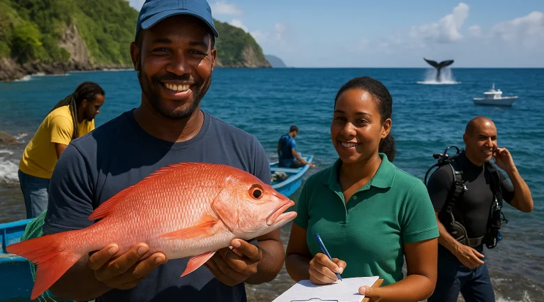
Fisheries are a daily expression of the blue economy in coastal communities around the island. The Caribbean Regional Fisheries Mechanism (CRFM) provides a concise national snapshot: 2,338 fishers, roughly 68.5 percent full-time, working from 42 landing sites. Historic landings in the early to mid-1990s ranged from 446 to 883 metric tons per year. Those figures appear in the CRFM country page and are repeated in later CRFM items that compile older Dominica profiles.
A classic FAO national report breaks down typical annual yields by fishery type, giving a feel for composition: reef fisheries about 168 tons, deep slope about 58 tons, coastal pelagics about 485 tons, and large pelagics about 195 tons. The ratios track local gear, habitat and seasons, and they echo the multi-species character of small-boat fleets in the Lesser Antilles.
Independent compilations and statistical series suggest output has softened compared with peaks three decades ago, which practitioners attribute to storms that damage fleets and ramps, habitat stress, and changing market conditions. Sources place total production around the mid-hundreds of tons in the 2010s, with one World Bank and CEIC-referenced series noting approximately 776 metric tons in 2016. While figures differ across datasets, the directional story is consistent and it is one reason the CMSP and national policy emphasize cold chain reliability, sanitary handling and traceability rather than chasing volume alone.
Aquaculture is minimal and experimental as policymakers see potential in seaweed culture, ornamental fish and small shellfish pilots, but the prerequisite is a quality system that meets buyer expectations in hotels and export channels. The scoping study argues that investment in landing sites, ice and compliance systems is the biggest near-term lever for earnings, not a rapid expansion of effort at sea.
Marine Tourism, Wildlife Viewing and Ports
Marine tourism is a signature strength when the environment is healthy. The Mapping Ocean Wealth work under OECS CROP estimates that boat-based whale watching in Dominica generates almost 2 million US dollars a year in direct tourist spending, noting sperm whales, pilot whales, beaked whales, and seasonal humpbacks among the draw. The same country sheet points out that offshore charter fishing by a handful of operators contributes an additional 400,000 US dollars per year. A regional synthesis shows similar modeling across Eastern Caribbean states and situates Dominica’s marine assets in a broader map of reef tourism value.
Nearshore attractions concentrate near Soufrière and Scotts Head peninsula, where geothermal vents and vertical drop-offs create dramatic diving. Northward, the Cabrits National Park area blends shore-based history at Fort Shirley with nearby reefs and seagrass, plus cruise calls that have to be managed for waste, visitor flows and anchorage use. The official SSMR site, while designed for visitors, gives a useful sense of habitats and moorings that help reduce anchor damage on coral.
At the center of maritime logistics is the Dominica Air and Sea Ports Authority (DASPA), which oversees the majority of trade moving in and out of the island. The scoping study notes that more than 95 percent of imported tonnage enters by sea, which is typical for small islands but highlights how disruptions at the ports cascade through retail, construction and tourism. Planned port hardening, waste reception upgrades and streamlined cargo handling are classic blue economy investments, because they reduce environmental risk and lower costs for productive sectors at the same time.
Ecosystem Services, Climate Stress and why Management Matters
Coral reefs, mangroves and seagrass provide shoreline protection, nursery habitat and carbon storage that underpin livelihoods and property values. Dominica’s reef cover declined by about 10 to 15 percent between 2005 and 2015 in monitoring discussed in climate risk literature, which makes harbors and beaches more vulnerable to waves and storm surge. The CORVI analysis flags reef degradation and climate-exposed coasts among the most serious categories of risk, and also highlights invasive seagrass, heavy rainfall events and sediment loads as complications for water quality.
Marine protected areas help, but coverage is still modest. The Soufrière Scotts Head Marine Reserve is about 5.35 km² by WDPA account, and the Cabrits National Park Marine Section is 421. These sites protect nursery functions and concentrate visitor moorings in designated places, which improves compliance. The long-standing criticism is that enforcement budgets are thin and community co-management must be scaled up to fully realize benefits.
The CMSP is meant to translate principles into maps, operating rules and investment signals. The OECS listing confirms Dominica’s plan and its role in the regional portfolio, and academic work on Eastern Caribbean marine spatial planning explains why MSP has been adopted widely in small island settings with crowded coastlines. The approach aligns shipping approaches, anchorage zones, dive sites and fishing grounds, and it supplies a legal and participatory process to resolve conflicts.
Key Facts at a Glance
- Land area ≈ 751 km², coastline ≈ 148 km, EEZ ≈ 28,500 km², coastal population ≈ 50,000.
- Soufrière Scotts Head Marine Reserve: 5.35 km² reported area. Cabrits marine area: 421 ha documented sea area.
- Fishers: 2,338 registered, 68.5 percent full-time, 42 landing sites. Historic landings 446–883 MT in early 1990s.
- Annual yields by fishery type from FAO: reef 168 t, deep slope ≈58 t, coastal pelagics ≈485 t, large pelagics ≈195 t.
- Whale watching: almost 2 million US dollars a year direct expenditure. Offshore fishing charters: ≈400,000 US dollars a year.
- Sea-borne imports: over 95 percent of tonnage enters by sea, highlighting the importance of port resilience.
- Risk profile: 2024 CORVI identifies high risk from reef decline and climate-exposed coasts.
Opportunities, Risks, Future Outlook
The Blue Economy of Dominica presents diverse possibilities but also faces major constraints. Balancing growth, ecosystem integrity, community needs and international scrutiny requires a careful blend of opportunity-driven planning and risk management.
The most immediate opportunities are those where small investments fix bottlenecks. Cold chain reliability is the classic example. Many fishing villages report that ice supply, hygienic tables, clean water and basic storage are intermittent, which lowers prices paid to fishers and raises hotel reliance on imports. The scoping study recommends landing site upgrades, training in sanitary handling, and documentation systems that help fish reach higher-value buyers. Where fishers connect with hospitality procurement, more of the tourism dollar stays in village economies.
Eco-certified marine tourism is another quick win when reefs are healthy. Dominica’s whale-watching revenues, measured by Mapping Ocean Wealth at almost 2 million US dollars per year, already reflect a market willing to pay for wildlife experiences. Formalizing operator standards, scientific briefings and citizen science partnerships with dive shops can deepen value while improving environmental monitoring. The same applies to mooring management at popular dive sites, which prevents anchor scars and preserves coral structure.
Yachting services and small marina functions are logical extensions for Portsmouth and other harbors with natural shelter. Fuel, water, haul-outs, chandlery items and on-shore repairs increase visitor spending and allow year-round business lines. The CMSP helps by signaling where anchorage and approaches are compatible with reefs and fishing activity, and by defining speeds, routes and no-go areas to reduce conflict.
Planned aquaculture pilots emphasize caution, particularly with seaweed and shellfish. These species provide sustainable, low-trophic options that can perform well in nearshore sites where water quality is controlled. Policymakers are rightly cautious, since siting errors can cause conflicts with bathing, boating or habitats. Early pilots should be paired with water-quality monitoring and community consultations so adjustments can be made quickly.
Future possibilities include blue carbon finance, rewarding mangrove and seagrass conservation when supported by strong baselines and monitoring frameworks developed collaboratively by environmental agencies and Ministry of Finance. Marine biotechnology is often mentioned in regional plans, particularly for volcanic islands with unusual chemistry, though it demands strict access and benefit-sharing rules and a realistic timeline for returns.
The risks are both structural and immediate, with climate change the clearest threat. Warmer seas fuel coral bleaching, heavier rains send sediment and nutrients into nearshore areas, and stronger storms damage docks, moorings, and vessels. The CORVI work calls this out as a systems-level risk that touches every marine sector, especially where reefs, mangroves and seagrass already show stress. Reef cover declines of 10 to 15 percent in the decade through 2015, lower the natural breakwater effect and remove habitat complexity that supports fish.
Governance and enforcement capacity remain limiting factors. The scoping study refers to present arrangements as “balkanized governance,” meaning agencies focus narrowly on sectoral objectives without a common ocean plan. The CMSP is designed to fix that, but the plan must be anchored in law and backed by regular patrols, clear sanctions and public reporting. Fisheries data systems need attention too, because inconsistent or infrequent publication makes it difficult to detect trends and tailor effort controls.
Social equity often determines whether strategy succeeds or fails. Marine zoning that designates no-take areas can safeguard habitats and boost diving, yet abrupt closures risk marginalizing small-scale fishers without clear alternatives. International debates around “blue justice” are not abstract in Dominica, given the number of full-time fishers and the tight linkage between coastal culture and work. Designs that include compensation, phased rules, training and micro-grants for gear upgrades tend to keep communities engaged.
Understanding the Criticisms
Critics also argue that flagship projects sometimes get more attention than practical fixes. Wastewater plants, stormwater controls and watershed reforestation reduce turbidity and nutrient pulses that suffocate reefs, yet these basics can lag behind as attention goes to glossy construction. The planning documents and CORVI analysis imply that water quality is a foundational variable for both fisheries and tourism, suggesting that investments be sequenced so that environmental infrastructure is not an afterthought.
Looking forward to 2035, the target is an operational CMSP, clear zoning, routine monitoring dashboards for reef condition, fish landings and visitor distribution, and a financing mix that goes past project grants. The OECS listing confirms Dominica’s planning status, while academic literature explains why Eastern Caribbean states have embraced MSP as a management tool. If monitoring shows reefs stabilizing and post-harvest losses falling, the government’s premise holds: earnings rise and risk falls at the same time. If not, the risk is that marine assets degrade faster than promotional narratives can keep up, which undercuts both livelihoods and brand.
Priority Actions 2025-2030
- Harden landing sites and cold chain in Soufrière, Scotts Head, Marigot, Castle Bruce and Portsmouth. Pair ice supply and hygienic tables with training and traceability so fish can serve hotels consistently.
- Publish quarterly fisheries and reef dashboards. Use simple tables for landings by gear and location, and standardized reef metrics. Transparency builds trust and guides adaptive rules.
- Enact and operationalize the CMSP with legal backing, patrol schedules and public maps of zones, moorings, anchorages and routes, to reduce conflicts and protect sensitive sites.
- Scale eco-certification for whale watching and dive sites. Link operator standards and citizen science data contributions to marketing privileges.
- Upgrade port waste reception and storm resilience at DASPA facilities to cut pollution risk and keep supply chains moving during severe weather.
- Pilot low-trophic aquaculture with water-quality monitoring and siting rules that respect bathing and habitats, then scale what works.
- Plan for blue carbon by establishing baselines for mangroves and seagrass, pursuing small grant windows now while preparing for larger carbon finance later.


