
Interior of Dominica
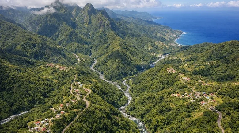
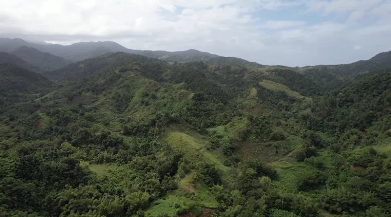
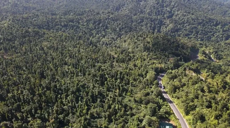

Exploring the Interior of Dominica reveals a landmass defined almost entirely by its sheer verticality. Previous definitions often constrained the “interior” to a limited boundary, primarily focusing on portions of the parishes of Saint Joseph, Saint David, Saint Paul, and Saint Andrew. However, an accurate topographical, biological, and cultural analysis reveals that the true interior is vastly larger. It encompasses the entire central geological spine of the island, a continuous, rugged mountain range that dominates over sixty percent of our island’s total landmass.
This expansive interior stretches from the northern flanks of Morne Aux Diables down through the massive Morne Diablotin massif, across the central plateau of the Central Forest Reserve, down into the volcanic calderas of Morne Trois Pitons, and terminating in the southern highlands near Morne Plat Pays. It effectively touches almost every parish, dictating the climate, hydrology, ecosystems, and human settlement patterns of the Nature Island of the Caribbean.
The Northern Interior: The Realm of the Giants and Parrots
Expanding our view northward into the Parishes of Saint Peter, Saint John, and northern Saint Andrew, we encounter the most formidable and remote section of the interior: the Morne Diablotin massif. Rising to a staggering 4,747 feet (1,447 meters), Morne Diablotin is the highest peak in Dominica and the second-highest in the Lesser Antilles.
This northern interior is historically and ecologically distinct. Established in the year 2000 to protect vital avian habitats, the Morne Diablotin National Park forms the core of this region. The western slopes of this interior sector are home to the Syndicate Nature Trail and the Syndicate agricultural estates. Syndicate represents a critical transition zone where high-altitude mountainous rainforests blend into some of the most fertile farming lands on the island.
This specific region is the absolute stronghold for the island’s two endemic parrot species. The Sisserou Parrot (the national bird) and the highly vocal Jaco Parrot rely on the ancient, undisturbed canopy of this northern interior. Decades of dedicated work by researchers and local conservation figures, including prominent local avian experts and the Forestry, Wildlife, and Parks Division, have focused on monitoring nesting sites high in the giant Gommier Tree and Chatannyé Tree trunks.
The Central Corridor: Historical Crossroads and Hydrological Core
Moving southward, the northern highlands merge into the central interior, which encompasses the Central Forest Reserve and the traditional boundaries mentioned in earlier, narrower definitions. This region features communities like Belles, Sylvania, Penrice, and the vital transportation hub of Pont Cassé.
However, the central interior extends much further east, deeply intertwining with the Kalinago Territory. The high ridges separating the territory from the interior valleys have served as traditional hunting and foraging grounds for the Kalinago, Dominica’s indigenous people, for centuries. It is in this central belt that the island’s immense hydrological wealth is generated.
The interior here acts as a massive sponge. The region receives upwards of 300 inches of rainfall annually. This water filters through the fertile volcanic soil to birth the island’s most powerful river systems. The Layou River, the island’s largest, begins its journey here, carving deep gorges through the volcanic basalt as it travels westward. To the east, rivers carve through the rugged interior valleys of Castle Bruce and Rosalie.
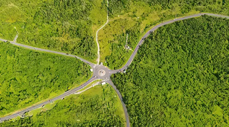
This central corridor is traversed by the Dr. Nicholas Liverpool Highway. Named after a former President of Dominica, Dr Nicholas Liverpool and an esteemed jurist, this feat of engineering is the primary lifeline connecting the coasts. Maintaining this highway through the unstable, rain-soaked topography of the interior is a constant, monumental task managed by the Ministry of Public Works.
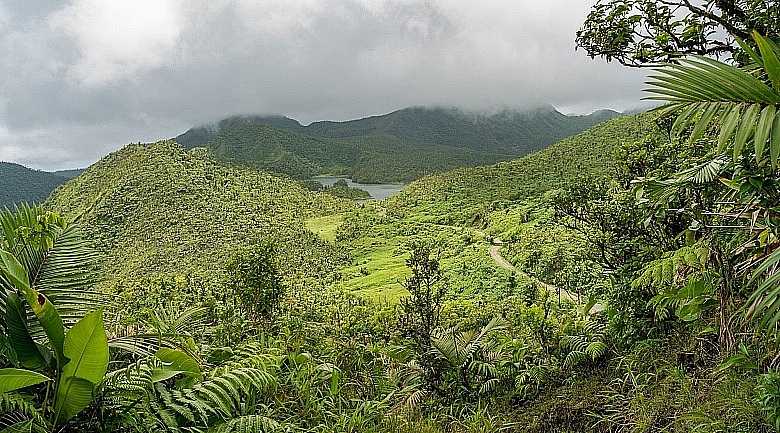
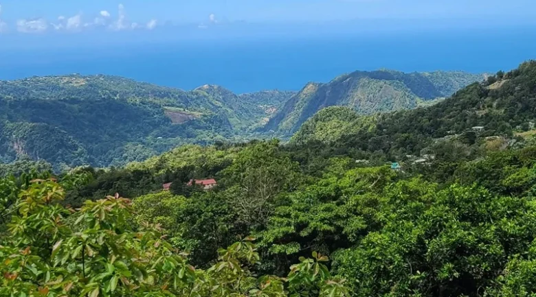
The Southern Interior: Geothermal Calderas and The Roseau Valley
To restrict the interior to the central parishes completely ignores the most dynamically active and heavily visited portion of the island’s highlands: the southern interior, primarily located in Saint George and Saint Patrick parishes.
This southern sector is dominated by the Morne Trois Pitons National Park, established in 1975 and recognised globally as a UNESCO World Heritage Site in Dominica. This region is defined by extreme geothermal activity and staggering topographical drops.
Key communities in this southern interior include:
- Laudat: Perched at nearly 1,200 feet, Laudat is referred to as the “gateway” to the deep interior. It is nestled between Morne Micotrin (Morne Macaque) and Morne Watt and receives some of the highest rainfall on Earth. It serves as the primary launching point for expeditions to the Boiling Lake and Titou Gorge.
- Wotten Waven: Located deep in a caldera within the Roseau Valley, this village is the undisputed epicenter of the island’s natural hot springs and wellness tourism.
- Cochrane: An agricultural village located on a high plateau on the flanks of Morne Canotte, famous for its cooler climate, traditional agriculture in Dominica, and its unique annual Rabbit Festival.
- Morne Prosper and Delices: Villages that cling to the steep southeastern ridges, where the interior drops dramatically toward the Atlantic, featuring isolated, deeply entrenched agricultural communities.
The geothermal heat beneath this southern interior is currently the focus of the island’s most ambitious infrastructure project. The government, in partnership with international engineering firms, has developed a massive geothermal power plant near Laudat and Wotten Waven. This project aims to harness the deep volcanic heat to transition the entire Dominica economy away from fossil fuels, solidifying the island’s goal of achieving total climate resilience.
A Tapestry of Endemic Ecology and Botanical Architecture
Because the interior spans such a vast elevation gradient, from 1,000 feet in the lower valleys to over 4,700 feet at the peaks,it hosts a remarkably complex, multi-tiered ecological diversity & biodiversity.
The Forest Stratification
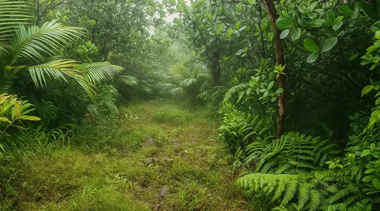
The lower elevations of the interior are dominated by primary rainforests. Here, the forest’s architectural giants, such as the Karapit Tree and the massive Bwa Dyab (Devil’s Wood), create a dense canopy that blocks out most sunlight. The forest floor is a complex matrix of decomposing organic matter processed by massive invertebrates like the Hercules Beetle.
As elevation increases beyond 2,500 feet, the interior transitions into the Montane Thicket. Here, the trees are shorterand thinner, constantly dripping with moisture frompassing clouds. Finally, at the very summits of Morne Diablotin and Morne Trois Pitons, the interior reveals the Elfin Woodland. In this harsh, wind-battered zone, trees are stunted, rarely growing taller than a few meters, and are entirely encased in thick, waterlogged mosses, bromeliads, and vibrant flora and fauna.
Interior Fauna
The deep interior provides absolute sanctuary for species that cannot survive the encroaching development of the coasts.
- Mammals: The Agouti and the Manicou are deeply integrated into the interior ecology, acting as primary seed dispersers.
- Amphibians: The interior valleys are the absolute frontline in the battle to save the critically endangered species in Dominica, specifically the Mountain Chicken frog (Crapaud). Conservationists have established specialized, climate-controlled bio-secure facilities deep in the forest to breed the surviving frogs away from the deadly chytrid fungus.
- Reptiles and Insects: The damp understory is home to numerous endemic snakes, the vibrant tree lizards, and complex leaf-cutter ant colonies that recycle the immense biomass of the interior.
The Historical Crucible: Maroons, Resistance, and Indigenous Paths
The geography of the interior has fundamentally shaped the human history of the island. Its sheer impenetrability made it the ultimate fortress for those resisting colonial rule.
During the late 18th and early 19th centuries, the interior became a sovereign territory for the Maroons, enslaved Africans who emancipated themselves and established highly fortified, hidden camps. The geography was their weapon. Figures like the legendary Chief Jacko, Pharcelle, and Balla operated sophisticated guerrilla networks from deep within the central and southern interior.
The most famous architectural remnant of this era is the Jacko Steps, a sheer staircase carved directly into a cliff face near the modern interior community of Belles. These steps allowed Maroons to access the hidden plateau known as Jacko Flats, rendering colonial pursuit practically impossible. The natural heritage of the interior is intrinsically tied to this fierce legacy of independence and survival.
Furthermore, long before the Maroons, the Kalinago people utilized a massive network of interior trails to traverse the island. These ancient footpaths laid the literal groundwork for the modern agricultural feeder roads and the world-famous hiking trails used today.
Modern Human Activity: Eco-Tourism, Agriculture, and Conservation Roles
Today, human interaction with the interior is heavily managed, focusing strictly on sustainability and specialized sports tourism.
The Waitukubuli National Trail
The expansive nature of the true interior is best experienced via the Waitukubuli National Trail. While earlier definitions only placed Segment #5 in the “interior,” a broader understanding reveals that Segment #4, Segment #5, Segment #6, Segment #7, Segment #8, and Segment #9 all plunge deep into the central mountainous spine.
The Economy of the Heights
The interior’s economy has shifted dramatically in recent decades.
- Sustainable Agribusiness: Moving away from monocrop bananas, interior farmers in places like Syndicate, Cochrane, and Sylvania now focus on high-yield, organic crops. The cool, wet climate is ideal for cultivating premium cocoa, robust coffee, exotic root crops (dasheen), and a vast array of botanical herbs used by local processors for essential oils and herbal teas.
- Professional Conservation: The expansive interior supports hundreds of highly specialized jobs. There are Forestry Officers who manage the protected boundaries, Trail Wardens who clear the Waitukubuli paths with machetes and chainsaws following heavy rains, and Eco-Tour Guides. These guides possess encyclopedic knowledge of the forest, leading international visitors safely to treacherous, hidden sites such as the Boiling Lake and the Emerald Pool.
Climate Resilience and the Future
Currently, the vast interior acts as the primary buffer against the devastating impacts of climate change. During catastrophic hurricane events, the towering peaks of the interior disrupt cyclonic wind flows, essentially absorbing the brunt of the storm’s energy to protect the leeward coastal settlements.
Because of this, the Dominica government views the protection of the interior’s natural resources as an absolute imperative. International funding through bodies like the Global Environment Facility (GEF) is continuously channelled into the interior to stabilise slopes, promote deep-root reforestation, and ensure that the vital watersheds remain unpolluted and free-flowing.
The true Interior of Dominica is not a small, designated zone in the center of the map. It is the overwhelming, dominant feature of the entire nation. From the cloud forests of Diablotin to the boiling cauldrons of the Roseau Valley, it is a massive, interconnected biological and geological engine. It holds the island’s water, its rarest wildlife, its deepest history of resistance, and the very blueprint for its future survival in a changing global climate.


References
-
1.
Morne Trois Pitons National Park (UNESCO World Heritage Site) https://whc.unesco.org/en/list/814/
-
2.
Morne Trois Pitons National Park: Volcanoes, Waterfalls & Rainforest Wonders https://paradisedominica.com/morne-trois-pitons-national-park/
-
3.
Natural Wonders on the Caribbean’s Island of Dominica – Audubon Magazine https://www.audubon.org/magazine/natural-wonders-caribbeans-island-dominica
-
4.
Places to Visit in Dominica – Responsible Travel Guide https://www.responsibletravel.com/holidays/dominica/travel-guide/places-to-visit-in-dominica
-
5.
Facts and Details About Dominica – Dominica Living https://www.dominicaliving.com/facts--details.html
-
6.
Dominica Country Profile – Imin Caribbean https://imin-caribbean.com/dominica/
-
7.
Dominica Rainforest Biodiversity https://www.worldwildlife.org/ecoregions/nt0129
-
8.
Adventure Travel Guide to Dominica’s Rainforest Interior https://www.wanderlustcaribbean.com/best-caribbean-island-for-adventure
-
9.
Dominica National Parks and Protected Areas https://forestry.gov.dm/units/national-parks-section