


National Physical Development Plan of Dominica
The statutory formulation, implementation, and continuous monitoring of the National Physical Development Plan of Dominica (NPDP) serve as the primary legal and spatial framework for managing land resources, infrastructure development, and human settlements across the island. Mandated under the explicit provisions of the Physical Planning Act No. 5 of 2002, the plan represents a comprehensive, multi-sectoral strategy designed to transition the country into a fully organised, economically viable, and climate-resilient nation.
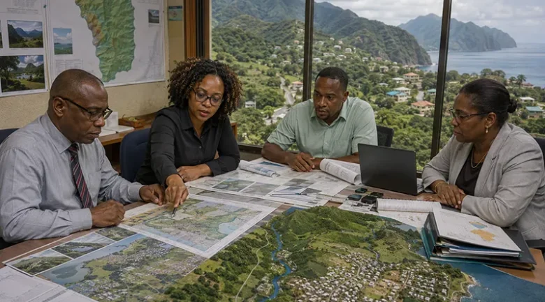
Administered and executed by the Physical Planning Division, operating under the Ministry of Housing, Land, and Urban Development, the plan moves Dominica away from uncoordinated land use toward a structured layout. It works directly alongside the National Land Use Policy (NLUP) to ensure that public infrastructure investments, private commercial developments, agricultural preservation, and environmental conservation balance the demands of economic growth with long-term climate adaptation.
Legal and Statutory Foundation
The structural legitimacy of the National Physical Development Plan of Dominica is grounded directly in the state’s planning laws, which govern how both public and private lands are utilized.
The Physical Planning Act No. 5 of 2002
Under Section 9 of the Physical Planning Act No. 5 of 2002, the legally appointed Planning Authority holds a statutory mandate to prepare, implement, and routinely review a strategic development plan for the island as a whole. This specific macro-level document is designated by law as the National Physical Development Plan. The Act grants the authority the power to create detailed localized Area Development Plans for targeted urban centers or high-risk zones, provided that these sub-plans conform to the broader guidelines set by the primary national framework.
The Institutional Mandate of the Physical Planning Division
The Physical Planning Division, led by the Chief Physical Planner, serves as the operational arm responsible for administering the national physical planning system. The division acts as the formal point of contact between developers, the public, and the government, carrying out several key statutory responsibilities:
- Reviewing applications for structural development, subdivision of lands, and outline planning permissions.
- Enforcing compliance with spatial zoning mandates, building guidelines, and the structural parameters of the approved Building Code.
- Formulating environmental protection boundaries in coordination with allied public departments to protect critical local watersheds, marine reserves, and coastal ecosystems.
Strategic Objectives and Core Components
The National Physical Development Plan of Dominica serves as a spatial blueprint guiding national development priorities, ensuring that land resources align with the country’s broader socioeconomic and environmental goals.
Environmental Integration and Climate Resilience
A primary objective of the modern planning framework is to anchor physical development within Dominica’s broader climate commitments, such as the Climate Resilience and Recovery Plan (CRRP). To protect communities from regular natural hazards, the planning system utilises comprehensive hazard maps to regulate development in highly vulnerable areas:
- Geological and Hydrological Risk Management: Spatial planning maps integrate detailed data on volcanic risks, landslide susceptibility, earthquake zones, coastal surges, and river-basin flood paths.
- Ecological Preservation: The framework coordinates closely with regulations established under the Forestry and Wildlife Act to maintain national biodiversity, protect inland rainforests, and minimize soil degradation along steep slopes.
Land Use Zoning Categories
To reduce land utilisation conflicts and manage changing real estate trends, particularly the growing international demand for eco-tourism and adventure tourism developments in remote areas, the plan categorises the national territory into specific functional zones:
- Agricultural Preservation Zones: Safeguarding highly fertile soils, particularly across agricultural valleys, to support national food security goals by restricting the arbitrary subdivision and conversion of active farms into residential estates.
- Residential and Settlement Boundaries: Directing housing projects toward safe, stable topography while discouraging unregulated sprawl that increases public infrastructure and utility distribution costs.
- Commercial and Industrial Hubs: Concentrating manufacturing, maritime cargo handling, and large-scale commercial centres within defined areas like Roseau and Portsmouth.
- Environmental Protection Areas: Restricting intense building construction near active river banks, water catchments, and protected ecological zones to maintain the island’s natural water systems.
Environmental Impact Assessment (EIA) Regulations
Pursuant to Part IV Section 23(1) of the Physical Planning Act No. 5 of 2002, the planning framework mandates that an Environmental Impact Assessment (EIA) must accompany applications for specific types of major structural developments. This process ensures that potential ecological disruptions are scientifically evaluated and mitigated before development permission is granted.
Mandatory EIA Categories (Second Schedule)
The statutory framework explicitly requires a full EIA for development applications falling within the Second Schedule of the Act, which includes:
- Hotels or eco-resort developments exceeding twelve rooms.
- Land subdivisions creating more than six distinct plots.
- Residential housing projects comprising more than six units.
- Quarrying, sand mining, and other mining extraction operations.
- Marinas, land reclamation projects, dredging, and the filling of natural ponds.
- Major public infrastructure including airports, ports, harbours, dams, reservoirs, and power plants (including hydro-electric and geothermal installations).
- Any industrial development involving the storage, use, or handling of hazardous materials.
- Any physical construction planned within sensitive ecological zones, such as wetlands, marine parks, national parks, conservation areas, or designated environmental protection areas.
Beyond the fixed list in the Second Schedule, Section 23(2) grants the Physical Planning Division discretionary authority to mandate an EIA for any other development project if it believes significant environmental harm could result.
Structural Building Codes and Subdivision Standards
To turn the plan’s spatial goals into reality on the ground, the Physical Planning Division enforces strict structural parameters, property setbacks, and layout rules across all parishes.
The Revised Building Code and Inspection Framework
The implementation of the updated Building Code establishes clear performance metrics for all modern construction projects. These measures are designed to ensure structures can withstand severe environmental loads:
- Wind Resistance Engineering: Roof structures, including purlins, rafters, and ridge beams, must feature mandatory hurricane ties and straps. For timber roofs, roof sheeting must be Gauge 24 or thicker to withstand extreme hurricane forces. Window and door openings are regulated to limit structural vulnerability, with total openings designed to resist high-velocity wind loads.
- Structural and Foundation Integrity: Foundation footings must be specifically sized and reinforced to match localized soil bearing capacities, utilizing tie beams for isolated footings and compacted soil bases.
- Multi-Stage Inspection Track: To enforce compliance, the Physical Planning Division requires a rigid framework of nine separate physical inspection points during construction. This process leads up to the final, mandatory issuance of an official Occupancy Certificate before any building can be legally inhabited or utilized.
Minimum Property and Boundary Setbacks
To maintain public safety, proper sanitation, and easy access along transportation corridors, the planning framework enforces strict minimum setback standards:
| Area Classification | Front Setback | Rear Setback | Side Setbacks |
| Standard Non-Congested Areas | 10 feet | 10 feet | 4 feet |
| Approved Planned Subdivisions | 10 feet | 15 feet | 10 feet |
| Congested Urban Centers (Roseau, Portsmouth, Mahaut/Massacre) | 5 feet (or match existing building line) | 5 feet, 6 inches | 2 feet, 8 inches |
| National Highways | 60 feet from the road centerline | — | — |
| Secondary Transit Roads | 30 feet from the road centerline (or greater than 10 feet from the road edge) | — | — |
Institutional Partners and Funding Frameworks
Because formulating and updating a comprehensive national spatial plan requires significant technical and financial inputs, Dominica collaborates closely with regional and international development partners.
The Caribbean Development Bank (CDB)
The Caribbean Development Bank has served as a primary financing partner for Dominica’s national planning initiatives, funding the major technical and consulting components of the combined National Land Use Policy and National Physical Development Plan project. This collaboration helped improve the technical capacity of local public planning officers by funding advanced Geographic Information Systems (GIS) software and training programs.
International Technical Consultants
To ensure the plan aligns with international best practices for small island developing states, the Government of Dominica has utilised specialised spatial development partners:
- Dillon Consulting Limited: A prominent international consulting firm from Canada that was brought in to lead the technical design, stakeholder consultations, and spatial layout structuring for the state’s national planning documents.
- The Global Climate Change Alliance (GCCA): Provided specialised technical support to carry out detailed preparatory vulnerability assessments, helping to integrate clear climate change adaptation strategies into the heart of the national spatial framework.


