


Colihaut Constituency
The Colihaut Constituency is a parliamentary electoral district in the Commonwealth of Dominica. It encompasses the communities of Colihaut, Dublanc, and Bioche within Saint Peter Parish. Established in 1975, it has played a significant role in the nation’s political landscape.
Constitutional and Electoral Framework
The Constitution of Dominica divides the country into single-member constituencies to elect parliamentary representatives to the House of Assembly. The Colihaut Constituency is one such division, and its boundaries are defined by the Electoral Boundaries Commission, as mandated by the Constitution.
Geographical Boundaries
The Colihaut Constituency is delineated as follows:
- North-East: From the sea along the boundary line dividing the parishes of Saint Joseph Parish and Saint Peter Parish to the source of the Espagnole River at St. Rose, then along a straight line to Morne Diablotin.
- South-East: From Morne Diablotin along a straight line to the point on the boundary line dividing the parishes of St. Peter and St. Joseph due south of Morne Les Resources, then along that boundary line to the sea.
- West: The Caribbean Sea.
Political Representation
Since its establishment, the Colihaut Constituency has been represented by various members in the House of Assembly:
- 1975–1980: F.F. Parillon
- 1980–1985: Alvin Armatrading
- 1985–1995: Clem A. Shillingford
- 1995–2000: Herbert Sabaroache
- 2000–2005: Branker F. John
- 2005–2009: Gerard Philogene
- 2009–2014: Ronald Toulon
- 2014–2022: Catherine Daniel (Dominica Labour Party)
- 2022–Present: Daren Pinard (Dominica Labour Party)
The Dominica Labour Party (DLP) has maintained a strong presence in the constituency, with recent representatives, including Catherine Daniel and Daren Pinard, affiliated with the party.
Cultural and Natural Features
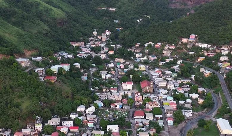
The Colihaut Constituency is renowned for its rich cultural heritage and natural beauty. Bioche, Colihaut, and Dublanc coastal communities are known for their vibrant traditions, including annual celebrations such as the feast of St. Peter, which reflects the area’s strong Roman Catholic influence.
Geographically, the constituency boasts scenic landscapes, including the Colihaut River and proximity to Morne Diablotin, Dominica’s highest peak. The coastline features grey-sand beaches, and the area is part of the Waitukubuli National Trail, offering opportunities for eco-tourism and hiking.
Infrastructure and Development
Infrastructure and governance within the Colihaut Constituency includes the Colihaut Primary School, Colihaut Health Center, Colihaut Village Council and community facilities. The Edward Oliver Leblanc Highway passes through the area, connecting it to other island parts. In recent years, the Government of Dominica has initiated projects to enhance resilience to natural disasters, especially following the impacts of events like Tropical Storm Erika in 2015.
The local economy is primarily based on agriculture, fishing, and quarrying, with efforts ongoing to diversify and strengthen economic opportunities for residents.
Anchoring Community and Representation
The Colihaut Constituency embodies the intersection of Dominica’s political history, cultural richness, and natural splendour. As defined by the Constitution of Dominica and overseen by the Electoral Boundaries Commission, it continues to play a vital role in the nation’s democratic processes and community development.