


Saint Luke Parish
Saint Luke Parish is one of the ten administrative parishes of Dominica and is located along the island’s southwestern coast. It is the smallest of all the parishes, comprising a single coastal village, Pointe Michel, and covers an area of approximately 7.77 km². Despite its size, Saint Luke plays a meaningful role in the country’s landscape, offering a mix of fishing villages, lush hillsides, and historical significance. The parish lies directly between Saint Mark Parish to the south and Saint George Parish to the north and northeast, with the Caribbean Sea forming its entire western boundary.
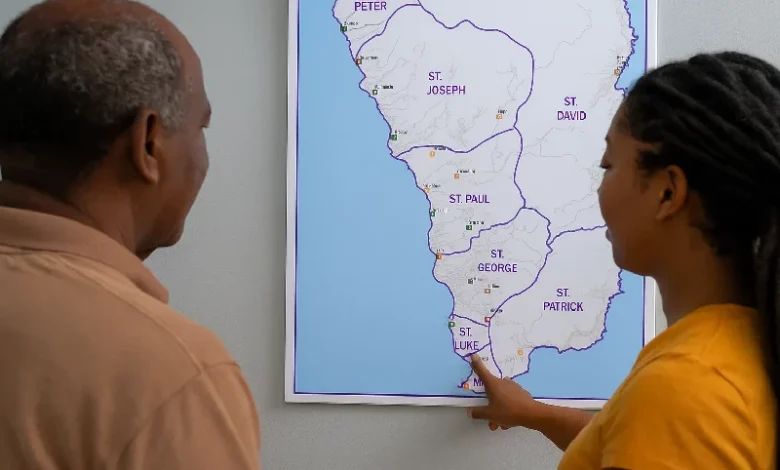
Geographic and Administrative Overview
Saint Luke Parish spans a narrow wedge of coastal and hillside terrain, bordered by Saint George Parish to the north and Saint Mark Parish to the south. The parish stretches from the outskirts of Loubiere to just north of Soufrière Bay, following the Loubiere Road that runs along the coast.
The primary settlement in the parish is Pointe Michel, a densely built coastal community nestled between steep mountain ridges and the Caribbean Sea. The village is flanked by ravines, such as Ravine Sibouli and Ravine Ambo Saut, which channel rainfall from the mountains into the sea. Inland, the parish rises sharply into hills leading toward Morne Plat Pays, but these higher elevations mark the transition into Saint Patrick Parish and are not part of Saint Luke’s administrative boundary.
Community and Cultural Life
Pointe Michel serves as both the spiritual and administrative heart of the parish. The St. Luke Catholic Church, one of the most historically significant churches on the island, was rebuilt after suffering severe damage during Hurricane Maria in 2017. Its reconstruction symbolizes the resilience of the community and has become a focal point for religious and cultural activities.
The village is also known for producing skilled artisans and cultural supporters, contributing significantly to Dominica’s creole heritiage month, funerary music traditions, and processional events during Catholic feast days. Pointe Michel’s seafaring heritage continues today, with many families engaging in small-scale fishing, boat repair, and coastal foraging.
Roads, Infrastructure, and Access
Saint Luke Parish is accessible via the Loubiere Road, also known as Victoria Street. This road connects Roseau, Dominica’s capital, to the southern coastal villages of Saint Mark Parish and Saint Patrick Parish. From Roseau, Pointe Michel is only about 3 kilometers away, making the parish a convenient residential community for people who work in the city.
Despite the rugged topography, the village is served by public transportation, and its compact layout ensures walkability. Roads within Pointe Michel, however, are often narrow and susceptible to erosion and flooding during the rainy season, particularly around low-lying ravines.
Natural Features and Attractions
While Saint Luke does not encompass many of the larger tourist landmarks associated with the south of Dominica, it still offers natural charm:
- Champagne Bay provides opportunities for scuba diving, snorkelling, and coastal photography.
- The coastal cliffs and vantage points below Morne Cabrits offer sweeping views of Scotts Head and Roseau.
- Ravine Sloubi, visible just south of the village, is one of several fast-running seasonal streams that add to the rugged aesthetic of the parish.
- The steep inland slopes toward Morne Plat Pays define the parish’s inland boundary and serve as an entry point into the cloud forests of the south-central highlands, though the summit itself lies outside Saint Luke.
Demographics and Social Institutions
According to the most recent population data, Saint Luke Parish has fewer than 1,000 residents, nearly all of whom live in Pointe Michel. The village is tightly knit, with a strong emphasis on family networks, religion, and community events.
Social services in the area include:
- A primary school serving the children of the parish
- A village council, which manages local affairs under the purview of the Ministry of Local Government
- A small health clinic, though residents often travel to Roseau for more extensive medical services
Economic activity is modest, with most working adults commuting to the city for employment. Local income is supplemented through fishing, remittances, and microenterprises such as small retail shops and taxi services.
Boundaries and Parish Relations
Saint Luke Parish’s boundaries are clearly defined on official maps:
- North: Bordered by Saint George Parish, near the community of Loubiere
- South: Stops short of Jungle Bay Resort, opening into Soufrière Bay.
- East: The boundary climbs toward the lower slopes of Morne Plat Pays, but does not extend into the national park or volcanic areas
- West: Bounded by the Caribbean Sea
This precise delimitation separates Saint Luke from neighboring parishes that include more diverse terrain and larger populations.
Challenges and Development
Due to its topography and proximity to the sea, Saint Luke Parish faces several ongoing challenges:
- Coastal erosion threatens road infrastructure and housing along the shoreline
- Landslides and flash flooding during heavy rains, particularly in ravine areas
- Limited land for expansion due to steep terrain and small size
Nonetheless, there have been calls for increased government investment in climate-resilient infrastructure, including slope stabilization and improved drainage systems. The Office of Disaster Management has also identified Pointe Michel as a community requiring high-priority disaster preparedness due to its exposure risks.
Efforts are ongoing to enhance community resilience, with projects such as:
- Emergency evacuation signage and drills
- School-based disaster education programs
- Exploration of eco-tourism potential related to nearby trails and coastal vistas