


Pont Cassé-Hatton Garden Road
The Pont Cassé-Hatton Garden Road is one of Dominica’s key interior transportation corridors, stretching from the central hub of Pont Cassé in Saint Paul Parish eastward to the coastal area of Hatton Garden. It serves as a vital link connecting the island’s central and eastern regions, cutting across rugged terrain and intersecting several interior communities, the Northern forest reserve and the Central forest reserve. The road plays a critical role in national connectivity, especially between Roseau, the northeast coast, and areas like Marigot and Belles.
Geographic Features and Usage
The route traverses mixed landscapes including lowland farms, mountainous rainforest, and ridgeline settlements. It also crosses portions of the Waitukubuli National Trail, notably Segment #5 and Segment #6, allowing access for hikers and eco-tourists. Along its path, it services agricultural zones focused on bananas and root crops while also doubling as an evacuation and emergency response route during natural disasters. Its position makes it strategically important for both local economic activity and national disaster preparedness.
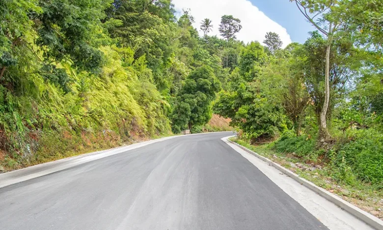
Upgrades and National Projects
In recent years, the road has seen major reconstruction under the Disaster Vulnerability Reduction Project (DVRP). Over EC$126 million was invested to improve drainage, widen lanes, stabilize slopes, and reinforce bridges. These upgrades enhanced resilience to storms and landslides, making the route safer and more reliable for daily and emergency transport.