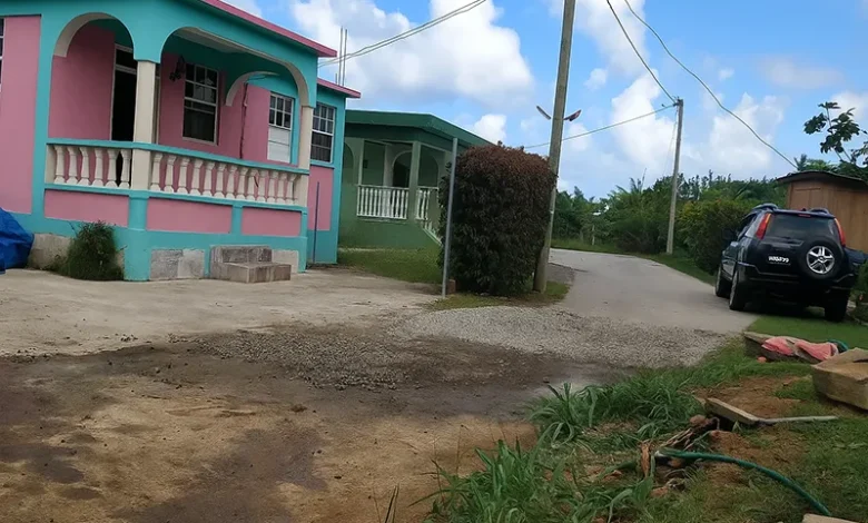
Riviere Cyrique

Riviere Cyrique is a coastal community located along Dominica’s eastern shore in Saint David Parish. Tucked between steep ravines and coastal cliffs, this village is known for its meandering roads, distinct topography, and access to one of the island’s most secluded beaches and waterfalls. It falls under the Morne Jaune/Riviere Cyrique Village Council and is represented within the La Plaine Constituency.
Riviere Cyrique’s Geographical Features and Access
Riviere Cyrique sits at the end of a winding segment of Morne Jaune Road, which loops sharply through the hillside before dropping toward the Atlantic Ocean. The community is hemmed in by several natural landmarks, including the Rosalie River to the north and the Ravine Ma Robert, which cuts through the terrain on its way to Rosalie Bay. This river feeds into the iconic Wavine Cyrique Waterfall, a popular eco-tourism site that drops directly from a cliff edge into the sea.
The terrain around the village is mountainous and dissected by ravines such as Ravine Cutty and Ravine Mouton. Ma Robert Road and S’Oliver’s Road branch from the main path and lead to residential clusters that spread across the slopes. Several footpaths provide access to forested areas and traditional farmland that has been used for generations.
Village Layout and Services
The housing in Riviere Cyrique is sparse and adapted to the hilly terrain, with homesteads perched on narrow ridges or nestled into steep inclines. The road layout is informal but distinct, with serpentine curves that mirror the contours of the land. At the same time, the remote community is served by the Riviere Cyrique Health Centre, a key local facility offering basic health services to residents in the eastern interior.
Despite its limited infrastructure, the area maintains a close-knit communal structure, governed locally by the Morne Jaune/Riviere Cyrique Village Council, which plays an active role in managing roads, coordinating environmental cleanups, and overseeing disaster preparedness in this climate-sensitive zone.
History, Agriculture and Land Use
Historically, Riviere Cyrique has maintained agricultural traditions tied to the larger Grand Fond farming belt. Land plots in the upper elevations, like Décovert, Monsieur Pierre, and Tête Grand Fond, are actively farmed for root crops and citrus fruits. Grand Pond Road, located to the west, connects Riviere Cyrique to the neighbouring communities of Gardie and Grand Fond, allowing movement of goods and people despite the difficult terrain.
The surrounding rivers and ravines have historically influenced the layout of farms and dwellings. Some lands along the riverbanks remain prone to erosion and landslides, especially during the hurricane season, but continue to be used due to the fertility of the soil and traditional land claims.
Tourism Potential and Conservation
The Wavine Cyrique Waterfall has become one of the most striking natural attractions on Dominica’s east coast. While its descent is challenging and not suited for all visitors, it is a bucket-list destination for adventurers seeking dramatic coastal views and hidden forest trails. A footpath known as Turtle Beach Trail offers access to a narrow beach area below, which, though difficult to reach, enhances the mystique of the location.
Turtle nesting activity is also reported near the Rosalie Bay area, to the immediate north of Riviere Cyrique, making this corridor environmentally significant. The entire coastline is framed by towering cliffs, protected coves, and scattered forest, making it one of Dominica’s more pristine natural environments. The balance between conservation and responsible tourism development remains a local priority.
Cultural Identity and Outlook
Riviere Cyrique maintains cultural links with nearby villages such as Morne Jaune, Grand Fond, and Rosalie. The region shares music, food, and community events tied to Saint David Parish traditions. Church festivals, seasonal crop rituals, and village meetings remain central to the social life of the area.
While economic opportunities remain limited and young residents often relocate to urban centers like Roseau or seek work abroad, there is renewed interest in revitalizing the area through sustainable tourism, road rehabilitation, and local enterprise development.
Riviere Cyrique remains defined by its striking landscape and steady spirit, a village nestled between ocean and hill, holding fast to its roots while adapting to changing times and national priorities.


